A good map is useful when planning your trip or finding your way around when you are at your destination.
Foto: Jonas Sjøgren
Cabin map
Here you will find a map of the cabin areas in Trysilfjellet.
See map here
Høyfjellssenteret and Fageråsen Hytteområde
See map here
Tourist centre, cabin area south, Storsten, Mosetra and Trysilfjellet Arena
Alpine maps
On SkiStar's website, you will find both alpine maps and useful information about open lifts and slopes.
Alpine maps
Map and info about open lifts and slopes
Cross-country skiing map
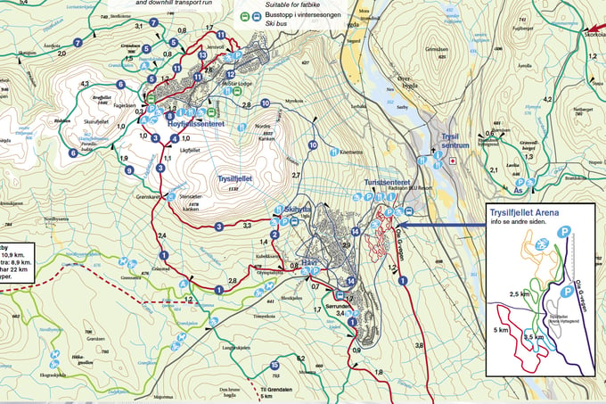
Here is a cross-country map for Trysil
Recommended walks in winter
Not everyone chooses to go cross-country skiing or alpine skiing. Walking is for everyone, but it can be difficult to know where it is nice to walk. Examples of such trips can be found on the maps below.
See map here
Høyfjellsenteret and Fageråsen Hytteområde
See map here
Tourist center, cabin area south, Storsten, Mosetra, Trysilfjellet Arena and the city center
Hiking map - hiking and hiking
On UT.no you will find both good tour descriptions and maps. Here you will also find information about our hiking program Trysil's summit tours and Hiking pearls in Trysil.
Sist oppdatert 26.01.2025